


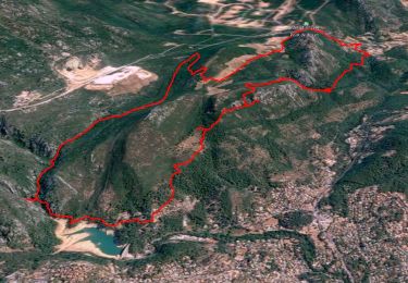
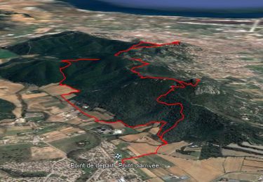
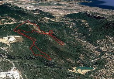
11,9 km | 19,4 km-effort


Benutzer


Kostenlosegpshiking-Anwendung
 SityTrail
IGN / Geografische Institute
SityTrail World
Die Welt öffnet sich für Sie
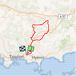
Tour Fahrrad von 88 km verfügbar auf Provence-Alpes-Côte d'Azur, Var, La Garde. Diese Tour wird von tracegps vorgeschlagen.
Circuit assez facile au départ du stade Guy Moquet à La Garde. Une seule petite difficulté la montée de Rocbaron depuis Cuers. Bonne balade
Wandern
Wandern
Wandern
Pfad
Wandern
Wandern
Wandern
Wandern

Zu Fuß